
Home / Shop
Stratigraphy - Cross Sections - GEO5

- Description
- Specifications
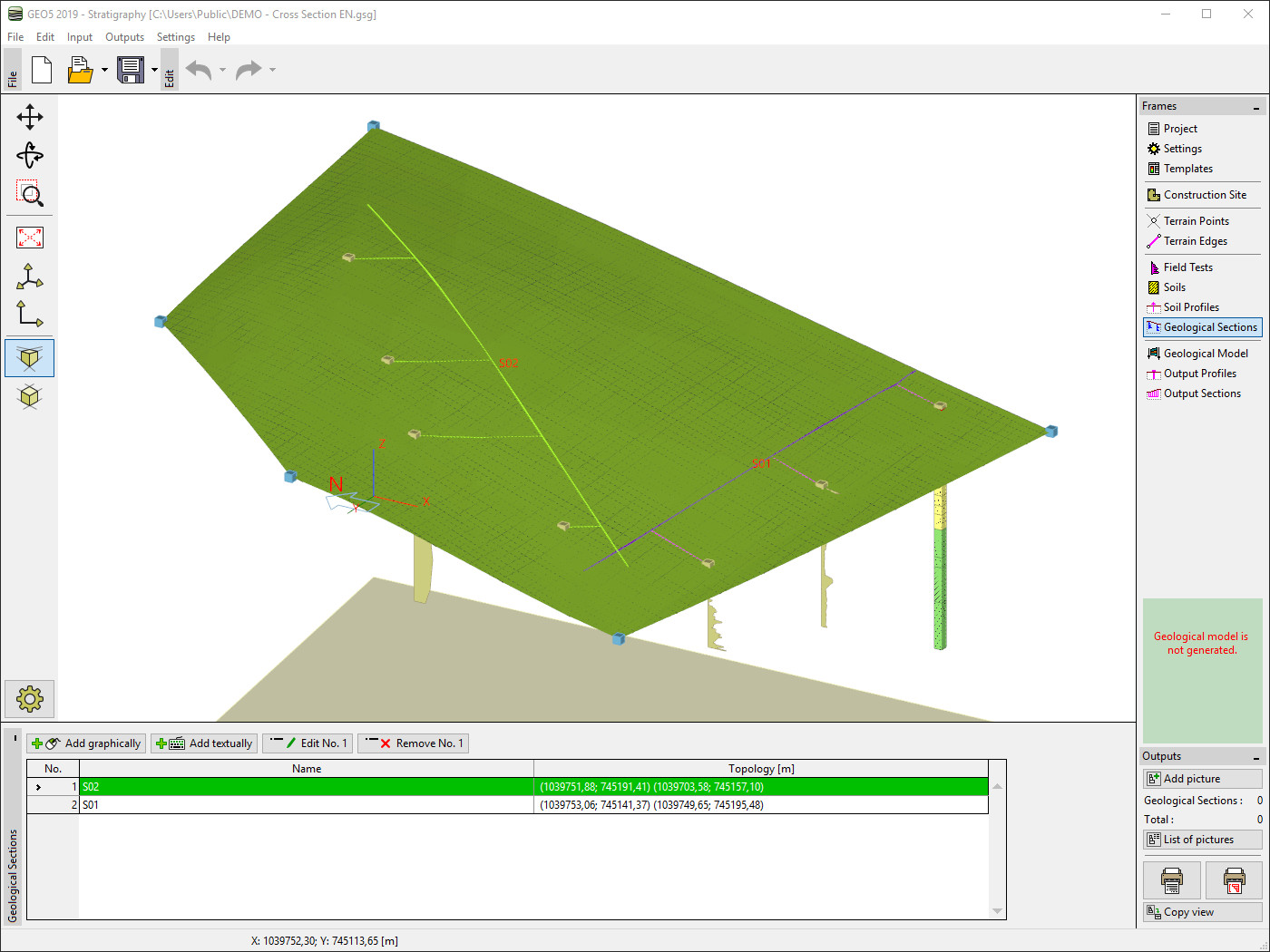
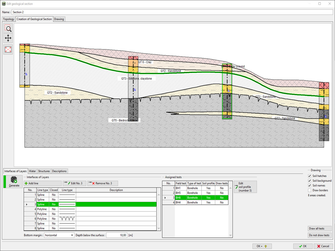
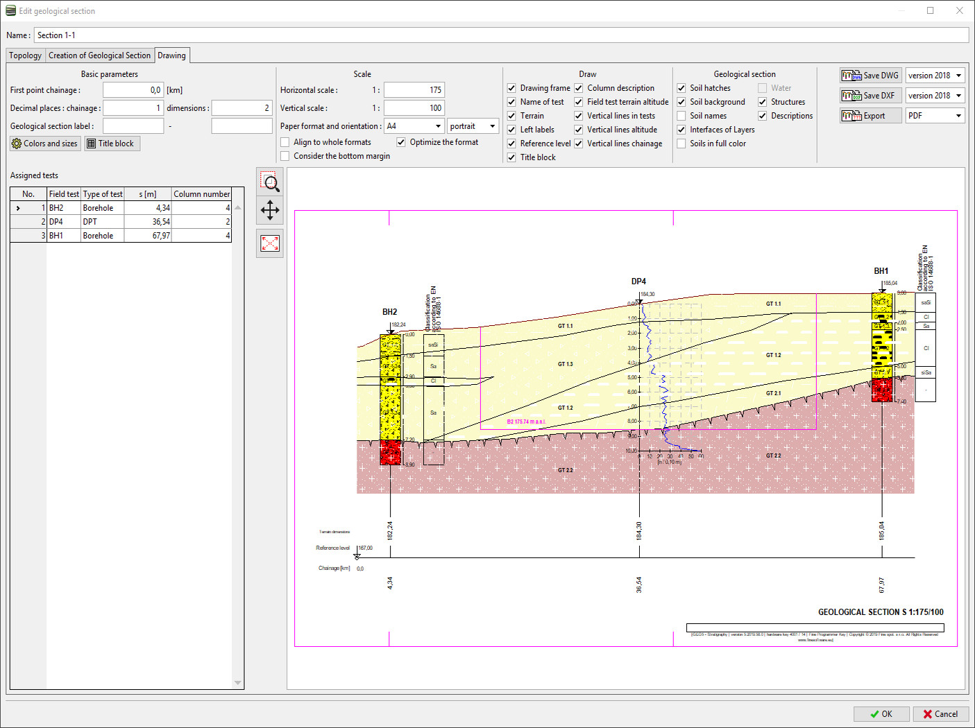
The Stratigraphy - Cross Sections module is designed for easy creation of geological cross-sections (including lenses, faults). It provides scaled outputs of the cross-section with field tests and soil profiles. No CAD program is needed.
For geological data reporting from site investigation results use Stratigraphy - Logs module. The modules are extensions of the Stratigraphy program.
Stratigraphy program with Logs and Cross Sections modules are available in the “Geology package” for US$2,200.
Main Features
- Straight or polyline shape of cross sections
- Viewing of selected field tests and soil profiles
- Easy input of interfaces between layers
- Creation of faults and lenses
- Definition of the geotechnical soil types and groups
- Input of different ground water levels
- Drawings of structures, auxiliary lines and user´s descriptions
- Different scaled outputs in both directions
- Possibility to display field test results or user-defined data for each layer
- Data preparation for 3D geological model
- Cross section export to PDF, DXF, DWG formats
- No CAD program is needed
Explanation of Product Terms
Hardware Key (Hardlock/HW Key): Hardlock is a piece of hardware (i.e. USB or dongle) used to eliminate software piracy. Therefore, the software only runs on a computer with connected hardlock. Licenses locked to hardware key are not limited to one computer, but to any computer with connected hardlock. For example, it allows the users to run programs on an office computer or on a notebook out of the office. For larger companies we offer Network hardlocks, which are attached to one computer on a network allowing product usage on other computers connected to the same network.
Software Key (SW Key): Software key is a unique code (Token) that is installed on a user’s computer, which works in a similar way like a hardlock. This key is bound to the hardware of a given computer. The first installation on the client’s computer is done using the software key Token. The software key is bound to the hardware parameters of a given computer on which the key is installed. If these parameters are changed the software cannot be launched until the issue is resolved by reporting the Hardware Changes (to restore the full functionality).
Token: Token is a onetime use unique code to install the software key on the client’s computer. For example, “1234_5_ABCDEFGHXYZABCLO” (1234 is user number, 5 is key sequence number)
Local Licence (Software Key): If you buy a local licence with a software key, the software can be installed and used on one computer only. If you buy a new computer, the key can be transferred (only if you have the commercial version of software). The software key is sent by email within working hours. Individual programs can be installed using one or more local keys according to individual user needs.
 Local Licence (Hardware Key): If you buy a local licence with a hardlock, you can install the programs on an arbitrary number of computers, however the programs will only work on the computer to which the hardlock is connected. Individual programs can be installed using one or more local keys according to individual user needs.

Network Licence (Hardware Key): Our network licences are only distributed with a hardlock. If you buy a network licence, you may use the software on more computers in the network. The maximum number of users that can work with the software at once is given by the number of purchased licences (i.e Max. 10 users or Max. 50 users). In order to run the application, the appropriate network hardlock has to be connected to a computer in the network.
Software Maintenance: Fine Maintenance subscribers get all updates and upgrades (new Editions) for free. Software Maintenance is available as an annual subscription for the amount of 15% of the software program and can be purchased in conjunction with your Local or Network licence. Please contact ETIA if you already have a Local/Network licence and would like to purchase maintenance separately.